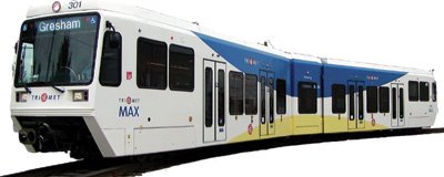
 A brand new release from Google is a takeoff of their Maps feature called Google Transit. This new program features to and from directions for locations, but instead of via car, via the available public transit. As a proponent of transit, this is extremely exciting. This sort of routemaking efficiency is all that's been stopping many from choosing transit as their transportation mode. I will say, the possibilities this new feature entails seem pretty cool.
Obviously, this first release is very beta, and so there are still bugs. It's exciting, though, for the potential it holds, not for what it is right now. Currently, only one metropolitan region is available, that being Portland, Oregon. I CANNOT wait until this expands to Chicago. At least I hope it will. Having multiple public transit agencies, and different ticket pricing schemes, this is just the place a tool like this would be useful. Whether it will happen here assumes of course that Chicago's agencies will be willing to release their data and work with Google. Some cities are not willing. For now, I won't worry about that. I'll imagine the possibilities this holds instead. At the very least, I hope this means they'll add the public transit locations and stations to their base Google Maps.
Someday soon, if the API is released by Google, I imagine a mashup whereby you could search for homes or restaurants within a certain distance of the el.
Or, for a trip to the suburbs, you would be able to time compare (transit vs. live driving time) and cost compare (fare vs. gas cost) your mode choices. You could select a trip where the first link was via transit and the second via car or vice versa.
You could even begin to add multi-city trips with jumps (airplane trips) in between transit and car portions of the trip. Very cool.

1 comment:
One of the reasons Google chose Portland is because TriMet is already such a technological leader in transit. You have long been able to enter a start and end location into TriMet's Trip Planner and receive detailed directions, times, transfers, and even alternate routes depending on whether you want the shortest walking distance, shortest length of trip, or least number of transfers. You can even tell it "I want to walk no more than ____" where the options are 1/4, 1/2, 3/4, or 1 mile. TriMet has also had schedules available for PDAs for a while, though they require a special reader software to use. There have even been a few wild unsubstantiated rumors flying about that TriMet might implement wireless at it's MAX stations, or even built into the trains themselves.
Another cool Portland transportation use of Google Maps is the Bicycle Route Finder.
Post a Comment